Special Program for International Students
GRADUATE COURSE IN EARTH SCIENCE
& GEOENVIRONMENTAL SCIENCE
Current MEXT students
Amila Sandaruwan Ratnayake (Sri Lanka)
Email: amilageopera @gmail.com
Thesis title: Paleoenvironmental reconstructions and evaluations of petroleum potential of the Mannar Basin, Sri Lanka.
Supervisor: Prof. Yoshikazu Sampei (2012-2015).
Sedimentary organic matter (OM) provides a variety of information that permits reconstruction of paleoenvironment and paleoclimate. Stagnant or semi-closed paleooceanic basins can also act as major depositional sinks for OM, and some of these basins develop as oil and/or gas generating systems. Study of organic geochemistry considering the relationship between past environments and OM types and concentrations thus provides fundamental evaluation of petroleum systems. The evaluation of source rock, its maturity and traps of reservoir rock are three key components that are essential for the occurrence of exploitable petroleum deposits. The objectives of my study in the Mannar Basin are:
- (1) investigation of past environmental and climate characteristics with respect to tectonic setting, from Late Cretaceous to Neogene;
- (2) evaluation of petroleum prospecting and modeling of petroleum formation in the Mannar Basin.
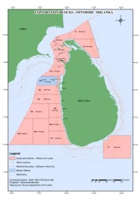
The Mannar Basin is situated between southeast India and western Sri Lanka (Fig. 1). Evolution of the N-S trending peri-cratonic Mannar Basin consisted of four main phases: a syn-rift phase (Late Jurassic to Early Cretaceous); rift transition phase (Aptian to Cenomanian); thermal sag phase (Late Cretaceous); and finally a passive margin stage. Breakup of the Eastern Gondwanaland landmass during the Early Cretaceous resulted in creation of new ocean floor between India and East Antarctica. The resulting basin contains a thick succession of sediments ranging from Late Jurassic to Recent in age. The oldest part of the sequence was deposited during the initial syn-rift phase, prior to initiation of seafloor spreading in the Bay of Bengal (Baillie et al., 2002).
The Petroleum Resources Development Secretariat (PRDS) of Sri Lanka recently carried out a drilling program in the Mannar Basin using the deepwater drillship Chikyu. For my study 403 drillcore samples were taken at 10 m intervals from two exploration wells, namely Dorado North (sampling depth range from 2200 m to 3622 m) and Barracuda (sampling depth range from 2139 m to 4741 m). Carbon, nitrogen and sulfur elemental, Rock-Eval, GC-MS, Pyrolysis GC-MS, vitrinite reflectance, organic petrography, visual kerogen and palynofacies analyses will be carried out during my Ph.D. study. The burial history, maturity, and timing of petroleum generation and expulsion will be modeled, based on computer simulations. The results of my previous M.Sc. research in Bolgoda Lake of western Sri Lanka will support the interpretation of the drill cores.


